Tuesday, November 11, 2025

How to cross the border from Panama to Costa Rica?

As for every trip, I had checked the website of the German foreign office to get information on Panama and Costa Rica. Write ups for both countries emphasised the importance of getting the exit stamp from Panama and the entry stamp from Costa Rica. So I searched and found two travel blogs explaining the process including photos for every step. So I felt ready to do it and let's be honest that's not my first border crossing by road.


Two years ago, I traveled by bus from Croatia to Bosnia-Herzegovina. We stopped at the Croatian side, got out of the bus, lined up, got our passports checked (and stamped). Boarded the bus, drove across the border, stopped on Bosnian side, got out of the bus, lined up, got our passports checked and stamped. And officially entered Bosnia-Herzegovina. 


Back to Panama, I arrived by Uber at the border in Paso Canoas. I found the building from the first steps of the blogs. I found the customs office and Panama Entry but not Panama Exit. The lady at the entry desk told me the exit is 5 km away. My answer: that does not seem logic. 


Step 1: Exit Panama (that was the theory)


Outside of the building several taxi driver offered me their services to the 5km away location including return trip for 15 USD. I was like I want to go to Costa Rica, not come back. I agreed with one driver to take me to the border center for 6 USD. When we reached there, he again made the 15 USD offer and I declined. 


This very new Centro de Control Integrado is a  shared building for Panama and Costa Rica, where you exit one country and enter the next in a single flow. I entered, I was the only foreigner there and got a Malaria test done - apparently they only had 4 cases in all of 2024 - so the chance of them calling you are pretty low. Then I went to the first row of desks and got my exit stamp for Panama. At the second row, I got my entry stamp for Costa Rica after answering some questions and providing my flight ticket to leave the country in two weeks. Last was the customs check. All in all, I was done in 10 min or less.

Aerial view of the new border center


The security guard at the other end of the building opened the door and asked me where my taxi is. I said I did not have one, so he showed me the way over the foot bridge to the main road. I had hoped there would be some Costa Rican taxis or that I could book an Uber to pick me up. Good idea but with no connection in the no man's land between the two countries, I was kind of stranded.

The exit to Costa Rica


So I rolled my suitcase (about 25 kg) along side the road (Panamericana) for 2.5 km to the next local bus stop. Luckily, it was around 9:30 in the morning, the road was busy but not so busy that they would run me over. At the bus stop (without any schedule), two elderly ladies were already sitting and waiting and told me the bus would come in 10-15 min. When it arrived, I paid my 1 USD fare as I did not yet come across an ATM.


I'm walking - down the street - I'm walking

Not my bus stop but a similar one

So what did I learn - I can be stubborn. There is probably a deal between the taxi drivers and the border center and the bus company. Otherwise, why did no-one created a new bus stop at the center when they opened it. Make sure to take water on your adventures - I drained one or two bottles on my walk. 

If you want to skip the walk, pay the 15 USD, go back to Paso Canoas and take the long distance/ regional or local bus that crosses the border to Costa Rica (but does not stop at the border center).

I definitely have another great story for my travelogue.

Monday, November 10, 2025

Panama: Tigerente, canal and hat


Ever since I first heard the story of “Oh, wie schön ist Panama” (Oh, how beautiful is Panama) as a child, Panama had a certain magic to it—the promise of adventure, discovery, and, of course, the legendary Tigerente. Arriving here felt a bit like stepping into that book, only with fewer talking animals and far more humidity.

Book cover (from Amazon)

And yes, the famous Panama hat that shows up on every postcard? It’s not actually from Panama at all—it’s originally Ecuadorian. But it became world-famous when canal workers, travellers, and even Theodore Roosevelt wore it here. Panama didn’t invent the hat, but it gave it its global stage. I got my Panama hat as earrings.


More than just a Panama hat

I squeezed a lot of Panama into a few days. It started with a long and beautiful day trip to the San Blas Islands, booked via GetYourGuide. After an early pickup and a winding drive through the hills, we switched to a small boat in Cartí and spent the day hopping between white-sand islands and clear turquoise water. 


Stop in the hills to the port

a boat like ours

By our vote, the first island we stopped to take on two passengers would have been our island of choice. Our real first where we got off the boat was nice and enjoyed the water. The next stop was in shallow blue water with white sand. Lunch and final (party) island did not convince us: crowded and surrounded by trash fields. Lunch was simple and fresh, and the company was great—including two American ladies I’d later meet again.

Island One


Stop 2: shallow waters

Stop 3: Lunch

Stop 4: the Party island

The next day I joined a six-hour tour to and partly through the Panama Canal. Gliding past giant container ships in the locks felt strangely calm—slow engineering in motion. The real scale hits only when you float right beside these steel giants: the canal moves roughly 5% of global trade, links more than 160 shipping routes, and still stands as one of the most ambitious engineering projects ever completed. Built by the United States after a disastrous French attempt, it opened in 1914 and instantly changed world logistics by cutting the Atlantic–Pacific journey by more than 13,000 km.


The Pacific Queen in the Miraflores lock (I'm on the ship)

We are followed in by this cargo ship which is hold in position by electric locomotives on the left and right.

Cargo ship

Miraflores lock and the Panama flag (to be seen everywhere)

The water is on level and the gates open.

With two ladies in Panama costume

After the cruise I headed to the Panama Canal Museum in the center. Halfway through the exhibits, the skies opened and a heavy tropical downpour trapped everyone inside. When the rain finally eased, the museum exit turned into my unofficial entry point into Casco Viejo.

Cathedral from outside

and from inside


I had arranged to meet the two Americans from San Blas for dinner, and we spent a relaxed evening catching up over good food and cold drinks. After saying our goodbyes, I let the warm night guide me through the narrow streets. Casco Viejo after dark has its own atmosphere: glowing balconies, quiet alleys, soft music in the distance, and souvenir shops filled with molas, masks, and canal miniatures. I wandered without hurry, simply enjoying the mood.


My dinner companions


Casco Viejo

The next day I caught a bus west to David. Bus travel in Panama is nothing like Europe: instead of quiet corridors and scheduled service stops, a rotating cast of vendors hops on and off selling empanadas, drinks, phone chargers—and occasionally even beauty products. The ride was long but entertaining, a moving snapshot of everyday life. I arrived by evening and spent a calm, uneventful night in the city.


My bus to David


Panama ended as it began—smoothly, unexpectedly, and full of small moments. Islands, rainstorms, history, Tigerente nostalgia, and long rides through green countryside. A short visit, but definitely a beautiful one. The real fun started with trying to get my exit stamp - stay tuned for the next post on the border crossing to Costa Rica.

Driving over the Panama Canal using the Bridge of the Americas


Sunday, December 8, 2024

Opening the ski season at Kronplatz

I had the plan to spend the first week of December skiing. Unfortunately, I realized about a month ago that the place I wanted to go to only opened a couple of days before Christmas. 


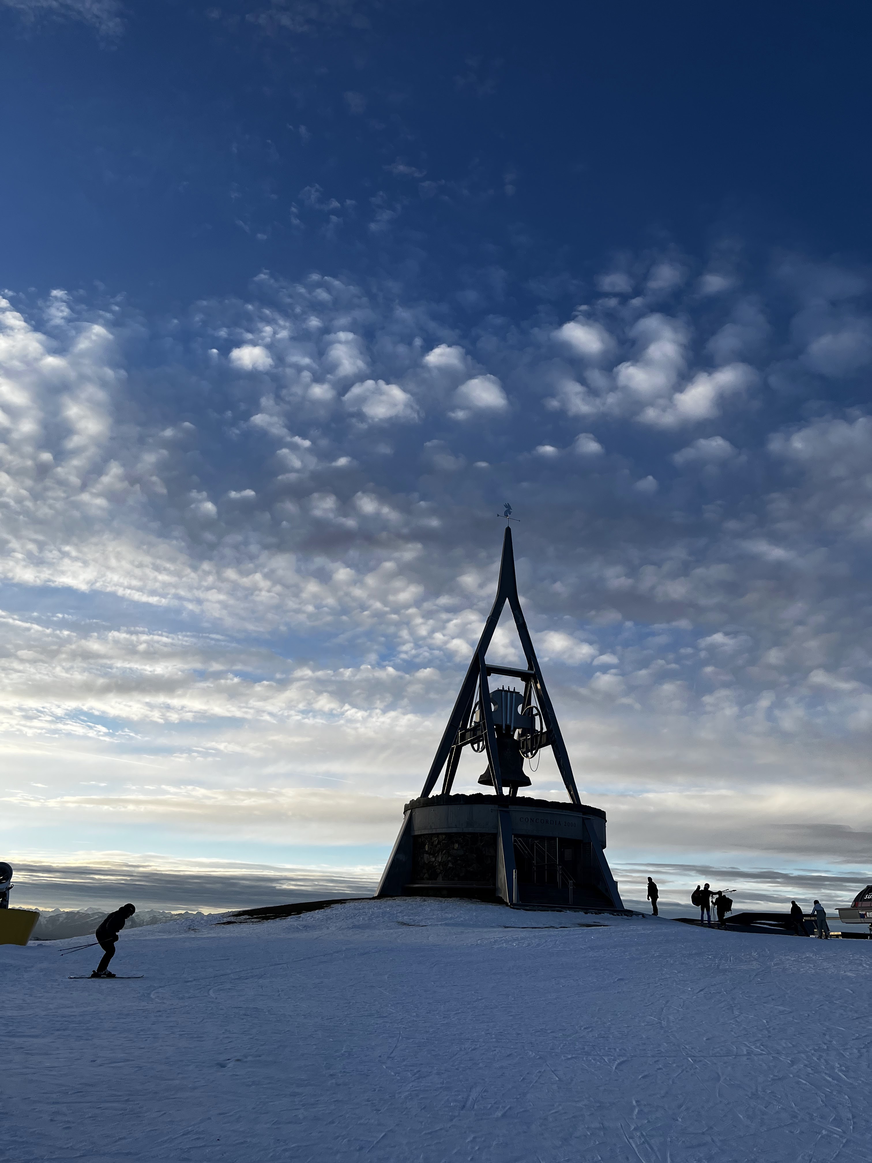
Kronplatz

So I postponed the decision where to go to the last minute. Making it dependent on snow, train access and qavailable accommodation in the vicinity. I decided for Kronplatz in Italy - 4h away from Munich by train with a transfer in Fortezza. 


When I arrived, I was positively surprised that the gondola started right at the train station. I got myself a locker and a ski pass and headed up the mountain. 


Over the next days I explored the Kronplatz ski area incl. St Virgil, Olang, Ried and Marchner. Some days the sun was shining, other it was snowing. So I was very happy to come back to a cosy and warm apartment in Perca. 

My favorite run was the black Sylvester going down to Kronplatz 1+2: long race tracks and steep slopes framed by snow covered trees.  


Sylvester


Friday and Saturday, I took the train to 3 Zinnen and enjoyed some different slopes there. Ski runs were snow covered back down to the valley and more and more runs were opened during the week. 


Winter Wonderland

3 Zinnen

Saturday afternoon I took the bus (that was free like the train with the guest cars I received) to Bruneck to visit the Christmas Market. As usual there was a good focus on food (e.g. sweets, Raclette and other things) but also handicrafts had their areas. Carol singers strolled around the different areas and sang Christmas songs. 

Bruneck


Christmas Market


All in all, it was a great experience and good accessible by train. 


Church of Perca


Friday, June 7, 2024

Simple history of Korea & a visit to the DMZ

In 1392, King Taejo founded the Joseon dynasty that ruled Korea for more than 500 years. During most of this time, the country remained isolated. King Taejo also invented the Korean alphabet. Before the Korean alphabet, Chinese was used. Interestingly, North Korea was using it since the 1950s while South Korea only adopted it in the 1990s.


Portrait of King Taejo in the Shrine of Felicitous Foundation in Jeonju


In the second half of the 19th centuries, Korea opened up to the outside world and particularly to the west. In 1910, the Japanese empire invaded Korea, demolished lots of old structures (buildings, palaces, etc). As Japan lost in World War II, Korea was divided in 1945 between US/ UN in the South and China and Russia in the North as the agricultural population was not seen as mature enough to rule themselves. 


By 1950, north and south had established own governments and the leader of North Korea decided to invade the south. A three year war period followed that led to an armistice. Both countries remained close in their development for several years, the North showing even better growth for some time. From the 19x0s, they went on a different trajectory.


Fence at the DMZ


Checkpoint to enter the DMZ 


In South Korea, several tour operators offer visits to the DMZ (Demilitarised Zone) which is two kilometres north and south of the boarder. At the time of my travel, visits to the Joint Security Area (JSA)at Panmunjom were suspended as in July 2023 an American soldier had crossed into North Korea during a tour. My tour started very early in Seoul (I was picked up at 6:30 in Itaewon). 

By 7:30, we had reached Imjingak Park where a visitor centre informs about the Korean war times. Our guide took our passports and application list to get tickets from the government office - there was a run on the tickets as there seemed to be more demand than tickets. At 9, he got the tickets and the assigned time for the government bus. 

I had booked a small tor with a visit to a suspension bridge as I thought it belonged to the DMZ. Instead the suspension bridge was only a tribute to South Koreans’ favourite pastime of hiking and has no historic connection. So feel free to skip it.


Suspension bridge


Tour highlights:


Imjingak Park

The visitor centre features several memorials to the Korean war, to reuniting families, to the girls that were enslaved by the Japanese as sex workers for the army. There is showcased a locomotive that has many bullet holes tand which was derailed in the Korean war, the freedom bridge over which prisoners of war were exchanged after the armistice. The park was built for South Koreans to commemorate their North Korean family members before the DMZ was opened.


More and more buses arrive


1950 locomtive with bullet holes


Freedom bridge


 Peace Momunment for "Comfort Women"


3rd infiltration tunnel

So far, South Korea has discovered four tunnels that the North has built to infiltrate the South - they were discovered between 1975 and 1990. More are expected to have been drilled. Some of the four tunnels are open to the public on a DMZ Tour. I visited the third tunnel. Before you go down, you watch a video with a strong American voice talking about the history of the DMZ, the tunnels and the wildlife - it feels strongly like propaganda.


To go down, you have to store your bags and phone in a locker, walk through a security check and take a helmet. Then you walk down a steep ramp for 375 m (down the interception tunnel). At the bottom I saw a wall that was prepped for the dynamite to clear the next couple of meters. I then walked 265 m in direction to North Korea, where the third concrete blockade with a window to see the second blockade marks the closest point you can get to North Korea (170 m). For this tunnel, it’s really good to be small as the tall ones dinged quite a lot to the ceiling of the tunnel.


Ready to enter the tunnel


Dora Observatory 

On the Dora mountain, is the observatory with binoculars directed at North Korea - I could see Chaeson Industrial Complex, Chaeson (city), propaganda village, fields, North Korean military post and radio towers from both side that should block signals from the opposing side. While I looked through the magnifying glass, I did not see any North Korean.


We are watching you!


View of North Korea


Unification Village

The bus stopped there for a 15 min shopping break at a DMZ grocery store that offered products from the zone: rice, alcohol, other food items. That felt a bit like a Kaffeefahrt (cheap coach trip with a sales show).


Unification Village


DMZ Supermarket